
This publication is categorised as a CSO Frontier Series Output. Particular care must be taken when interpreting the statistics in this release as it may use new methods which are under development and/or data sources which may be incomplete, for example new administrative data sources.
The best available data at a national level for land cover statistics is the CORINE Land Cover (CLC) dataset. Ireland's CORINE Land Cover dataset is produced by the Environmental Protection Agency (EPA) for the European Environment Agency (EEA) using satellite imagery and national land cover data. This is a comprehensive dataset giving full coverage of the country, with broad land cover classes providing a useful overview of the land cover types in Ireland. There are some limitations to its use for developing ecosystem accounts: it is designed to be a land cover product rather than an ecosystem map, the land cover classes are not refined enough to distinguish between some types of ecosystems, and the minimum mapping unit of 25 hectares means that a lot of detail is lost, especially for linear features such as rivers. To overcome this, we will also examine river and lake extent using EPA Water Framework Directive Data and National Parks and Wildlife Habitats Directive Article 17 Data. For more information on CORINE, see Background Notes.
Only a small proportion of the land area in Ireland is covered by rivers and lakes. In 2018 around 2% of the land cover was classified as rivers ('Water courses') or lakes ('Water bodies') based on CORINE data. The EU average was slightly higher, at just under 3% (Figure 2.1)
| Wetlands (excluding Peat bogs) | Peat bogs | Other semi-natural areas | Moors and heathlands | Forests and woodlands | Artificial surfaces | Croplands | Grasslands | Water bodies and Water courses | |
| Ireland | 1.1 | 13.7 | 1.4 | 1.8 | 9.5 | 2.4 | 12.3 | 55.8 | 2.1 |
| EU-27 | 0.5 | 1.5 | 3.8 | 1.7 | 37.6 | 4.8 | 37.1 | 10.1 | 2.8 |
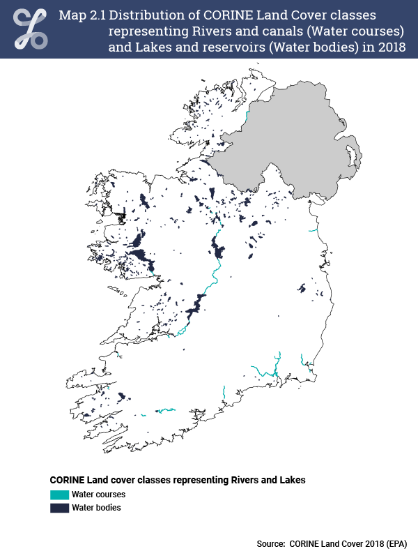
The distribution of rivers and lakes using CORINE data for 2018 can be seen in Map 2.1. Lakes occur more frequently in the midlands and north west of the country. Only the largest river systems are included in this dataset.
The total area of 'Water courses' (i.e. Rivers and canals) in 2018 was 6,764 hectares, while the total area covered by 'Water bodies' (i.e. Lakes and reservoirs) was 112,387 hectares. There was no change in extent from 2012 to 2018 for 'Water courses', and only a 4 hectare decrease in 'Water bodies'. Provisional extent accounts, using CORINE data, are shown in Table 2.1.
| Table 2.1 Extent account for Rivers and canals (Water courses) and Lakes and reservoirs (Water bodies) based on CORINE Land Cover 2012 and 2018 | |||
| hectares | |||
| Water courses | Water bodies | Total | |
| Opening extent (CLC2012) | 6,764 | 112,391 | 119,155 |
| Net change | 0 | -4 | -4 |
| Closing extent (CLC2018) | 6,764 | 112,387 | 119,151 |
Learn about our data and confidentiality safeguards, and the steps we take to produce statistics that can be trusted by all.